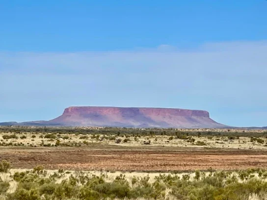

On our way to Uluru, also known as Ayers Rock, we spotted the incredible Mt Connor about 100 kilometres out. What a sight it was! Mt Connor is a stunning flat-topped mesa with 100-metre cliffs and a fascinating collection of rock fragments at its base. Unfortunately, you can’t drive there since it’s on private property—Curtain Springs Station. But even just seeing it from afar is truly special!
We had booked four nights at the Uluru Resort Campground. Our campsite was spacious and comfortable. It offered excellent internet access, power, and water, and we could enjoy a cozy campfire with a fire pit. There was even an IGA nearby, stocked with a variety of goodies! The mornings and evenings were chilly, hovering around 5 to 8 degrees, and the wind made it feel even cooler, but it didn’t matter; we were warm and comfortable in the van.
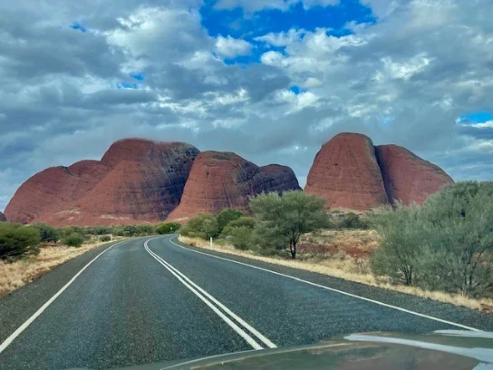
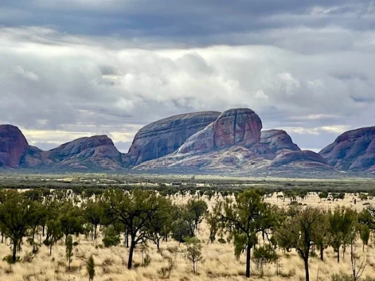
Our first adventure took us to the stunning Olgas, Kata Tjuta! Though the weather was a bit showery initially, we decided to wait for the skies to clear. Once they did, we set off in the afternoon and headed to the viewing deck. The unique rock shapes and vibrant colours after the rain were simply striking!
We looked forward to seeing the sandstone beauties up close, so we decided to walk to Welpa Gorge. The trail was a little rocky but had a gentle incline. Even though it had rained, only a light trickle of water flowed through. With the temperature at 11 degrees and a chilly wind blowing through the gorge, we felt cool in the air! The towering domes of the gorge, made from sedimentary rock, were terrific to see. Did you know that Mt. Olga stands 545.4 meters above the surrounding plains, making it nearly 200 meters taller than the nearby Uluru? What an incredible sight!
Kata Tjuta is the landmark’s original name, meaning ‘many heads’ in Pitjantjatjara/Yankunytjatjara. The first non-Aboriginal person to see Kata Tjuta was explorer Ernest Giles, who spotted the domes in 1872. He named the highest peak Mount Olga after Queen Olga of Wurttemberg (a kingdom in Germany at the time). The site was officially recognised with dual names in 1993, reflecting its European and Aboriginal significance.
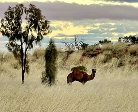
As we made our way back around 6:00 PM, we were treated to a stunning sunset. The sky was ablaze with vibrant shades of yellow and orange, casting a warm glow that refected off the clouds. It was as if the horizon itself was a canvas painted with the richest hues of the evening, creating dazzling sunset. On our way home, we spotted a feral camel. Feral camels were introduced in the 1840s for transportation purposes. However, with the advent of trains and trucks, many were released into the wild. These camels are known to consume a wide variety of plant species and can negatively impact water sources used by native wildlife and Aboriginal communities.
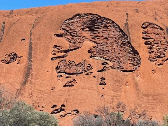
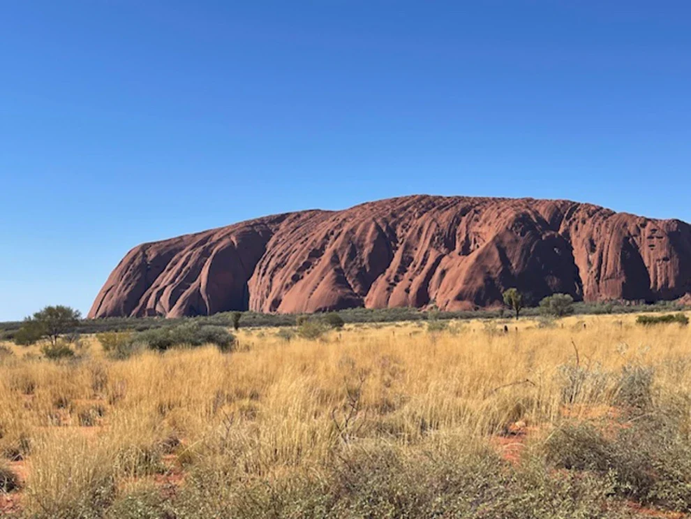
The following day, we set out early in the morning, excited for our journey to Uluru. As we approached the iconic rock formation, the vastness of the surrounding landscape took our breath away. Once we arrived, we embarked on a leisurely circumnavigation of Uluru, soaking in its majestic presence from all angles. Every inch of the rock seemed to tell a story, with deep crevasses and grooves that resembled intricate carvings. It was hard to believe that these formations were the result of natural erosion; they appeared almost as if they had been meticulously crafted by a master artist.
As we walked and drove around, the shifting colors of the rock, depending on the angle of the sunlight, created a mesmerising display.We took our time, pausing occasionally to snap photos and truly appreciate the iconic rock before us.
After our drive, we decided to stop by the cultural center, where we were greeted with the rich aromas of freshly brewed coffee and sweet cakes. After coffee, we caught up on the fascinating history of the area, learning about the significance of Uluru to the Aboriginal people through various stories and photographs presented throughout the center. These stories enhanced our appreciation for the landscape’s beauty and its rich cultural heritage.
The Uluri Resort offers free activities throughout the day. You can try the bush food experience, learn a little about Aboriginal art and more. There are numerous tour options, or you can self-navigate.
Geology: Mount Connor and Uluru beginnings
The geology of Uluru and Mount Connor began when sand from ancient nearby mountains was washed into the sea. Over time, these sands were compressed into sandstone. Sedimentary layers were uplifted between 340 million and 310 million years ago as the land experienced north-south compression. As a result of increasing pressure, some areas began to fold and fracture along lines of weakness.
Uluru’s rock strata are located on the north side of the east-west Uluru-Kata anticline, an upfold. These strata are inclined vertically. In contrast, the stronger strata in the nearby Mount Connor remain essentially horizontal. The rocks at the top of the anticline have been shattered and eroded over time.
Information sourced from A Guide to Australian Rocks, Fossils and Languages by Russell Ferret, and the Uluru-Kata Tjuta National Park website (https://uluru.gov.au/about/frequently-asked-questions/olgas-or-kata-tjuta).