
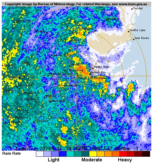
This is a BOM map of the Port Stephens area in April 2015, where we were preparing to leave in our catamaran, Sedna, a Lagoon 44. An East Coast Low developed off the coast, rapidly intensifying before making landfall at Nelson Bay.
It was a huge decision where to anchor to be safe. After studying the weather charts, we decided to trust the BOM forecast map and calculated the wind direction as the system passed over. Salamander Bay was the best choice, as it provided the safest option if we dragged anchor—we would drift into the mangroves rather than onto the rocks. Fortunately, we made the right decision. Several boats in the area, however, were not as fortunate; they failed to do their homework, resulting in some being damaged or sinking.
While anchored in Salamander Bay with 100m of 13mm chain out, we experienced wind gusts of up to 100 km/h. During these strong winds, our front headsail began to unravel. Typically, this situation worsens until the sail rips off the furler, which then rolls up and unfurls the sail even more. Mark had to crawl out onto the deck to secure it with extra rope. Luckily, this worked, and we avoided further trouble.
The weather was so rough that we couldn’t cook and had to survive on dry biscuits. Once the storm passed, the first thing we did was cook breakfast on the BBQ.
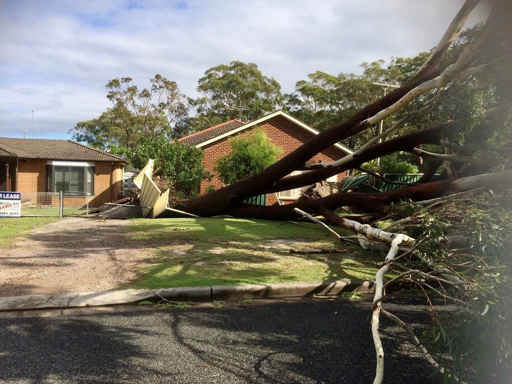
After enduring terrible weather on the boat for two days, we were eager to take a walk ashore to stretch our legs. We lowered the dinghy into the water and headed to land. Much of the damage in the Nelson Bay area was caused by large trees that had been uprooted due to the strong winds and heavy rain.
This is the BOM report:
Severe weather warnings have been issued today for damaging winds, heavy rainfall and very heavy surf for the Northern Rivers, Mid North Coast and Northern Tablelands regions. Communities in the affected area include Tweed Heads, Byron Bay, Lismore, and Coffs Harbour.
The conditions are caused by an intense low pressure system, often referred to as an East Coast Low, which is expected to move southwards along the Queensland coast and into New South Wales early on Saturday, before weakening and moving away from the coast on Sunday.
New South Wales Regional Director, Mr Barry Hanstrum, said that people living along the coast from the Queensland border as far as south Port Macquarie would receive the heaviest rain and strongest winds.
“Weather conditions over the northern New South Wales coast are already deteriorating and forecast to be at their worst overnight (Friday),” Mr Hanstrum said.
“Northern Rivers and adjacent districts will see heavy rain and thunderstorms with the potential for flash flooding, damaging winds gusting up to 100km/h, and very heavy surf.
“Falls in the range of 150 to 200mm are expected for northern New South Wales during this event, with localised falls over 350mm possible.
“Water levels could exceed the highest tide of the year during Friday evening’s high tide, mostly near the Queensland border,” he said.
Flood Watches were issued on Wednesday, and are current for New South Wales coastal rivers from the border to Nelson Bay for Friday, Saturday and Sunday.
Mr Hanstrum said the Bureau is acutely aware of ongoing clean-up operations in New South Wales, and mindful of the impact further rain could have in affected areas.
“Further rainfall is expected over catchments that experienced flooding last week, with renewed flooding still possible given the saturated landscape. However, we don’t expect to see the extreme rainfall totals and destructive winds that we saw in these areas during the last event.
“Thunderstorms are possible along the NSW coast, as far south as the Illawarra region, and these could lead to localised heavy falls,” he said.
The Bureau’s website remains the most up-to-date and comprehensive official source of information.